Posts

Showing posts with the label Fairview Ave

Ice-Covered Trees On The Metra Platform

Image
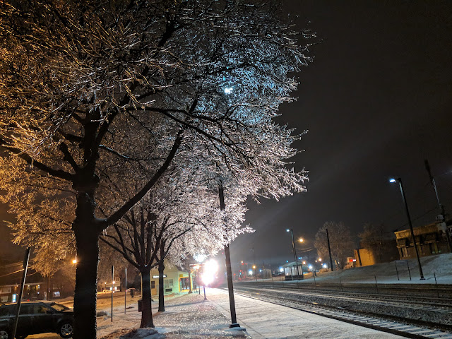
After shuffling down the driveway and through the middle of the street to avoid slipping on the ice, I was greeted by this glorious sight at the Fairview Avenue Metra Station one morning this month.  This was one of the early mornings moments that I was able to enjoy the Winter instead of just keeping my head down and trying to survive the day.

Fairview Avenue Metra Station Landmark Designation

Image
I just noticed these two plaques on the Fairview Avenue Metra Station in Downers Grove.  The bottom one says 2016, so it has been there for some time.  But, perhaps the top one is newish?  At least, I've never really noticed it despite walking by it a few times a week. They both mark the same thing:  the station as a 'landmark'. I found t his set of minutes from the Village of Downers Grove Village Board that recommended a resolution making the station a "Landmark Designation" . Here below is a closer look at the story in the bottom plaque: If you read closely, you'll see that this isn't the original station, but was built in 1916. I'm a little bit 'get off my lawn' on this landmark status.  Have you seen the Fairview Station?  Go look at it here in all of it's stucco glory . I love me some old, vintage buildings.  But it isn't the original station.  And now we've effectively handcuff our government into NOT changi...
Six Cameras/One Intersection in Downers Grove

Image
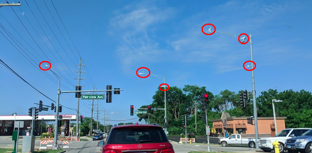
There I was, minding my own business waiting for the light to turn green when - for some reason - I notice that there are a few cameras at the intersection of Maple and Fairview in Downers Grove. I then look closer and start counting.  There are six cameras at this one intersection.  This is just a four-way intersection and if I'm being honest, I don't normally look around at the number of cameras, but I have to believe that this seems like a significant number of cameras trained on just one intersection?  Now, Maple Avenue does run on a diagonal and this *is* just a block or so away from the BNSF line, but other than that, it seems to be an ordinary intersection.  Any ideas?  I've embedded the map below: